Tyalgum Village
Like many towns on the Far North coast of NSW the village of Tyalgum exhibits the energy signature of a place where a massacre occurred. Although I have researched relevant history books relating to Tyalgum I have only found one reference which does not put a massacre right in the village itself.
The reference is as follows " These very earlier settlers simply pegged out the holding each one worked and then waited for it to be oficially surveyed. That is how it came about that after their holdings were surveyed Den Guinnea found that he had felled and cleared five acres of Dick James' farm. No doubt there was some adjustment arrived at between them. Incidently it was on Dick James' farm that the settlers caught up with the band of Aborigines that murdered the pit-sawyers at Murdering Creek ( now Myall Creek) and wreaked a terrible revenge on them.''
This reference to murdering creek ( Myall Creek) is a creek that runs into the Tweed River in the nearby town of Murwillumbah which also exhibits an imbedded massace site energy signature. According to the earliest maps I could find, W.R.James held land along Tyalgum Creek just outside the village itself.
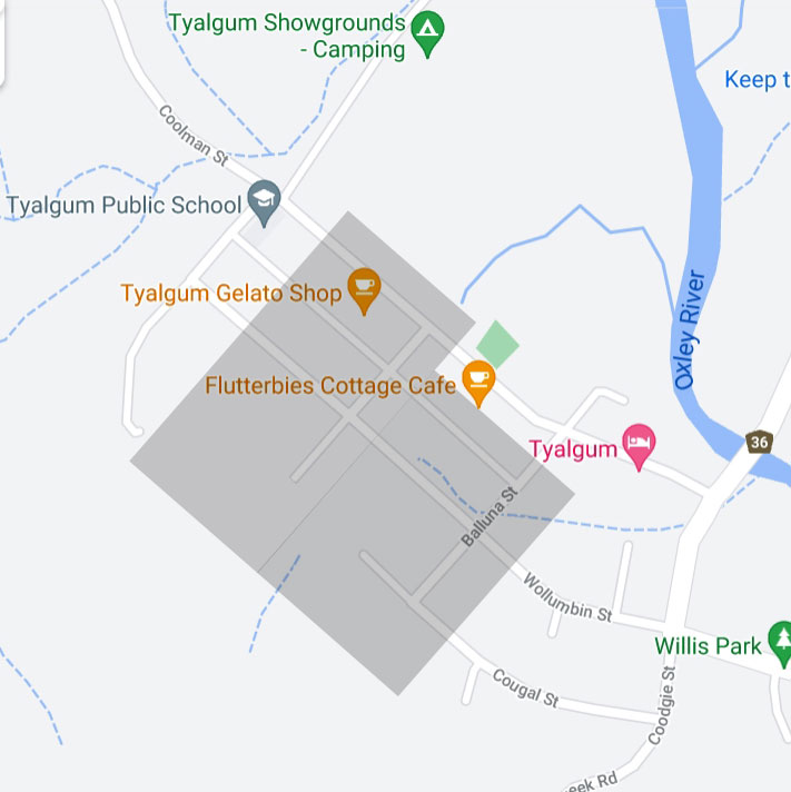
I can only assume that the massacre that occurred in the village happened before the village was created. The discharging negative energy signature ( shaded area of the map) is locked into the landscape and can not be denied by the absence of historical data.
Fortunately the school is not compromised except for a corner of the yard which does not appear to be a play area and the buildings are outside the effected zone. However the Tyalgum village hall is compromised by the massacre signature. The shaded area of the geopathic zone is also approximate as I am unable to go onto private property while mapping.
.